
Dubai Municipality has completed the Middle East’s first pilot project using advanced mobile mapping technology to survey waterways and canals.
The initiative used a specially equipped vessel fitted with the Leica TRK system to capture highly accurate spatial data along the Al Jaddaf water canal.
The project produced detailed datasets and precision 3D models, in collaboration with specialised partners, creating new opportunities for more efficient urban planning and infrastructure management.
Engineer Maitha Alnuaimi, Director of the GIS Centre Department at Dubai Municipality, said the project supports Dubai’s Digital Twin initiative by helping government entities make faster and more accurate decisions using reliable geospatial data.
She added that the initiative reinforces Dubai’s leadership as a smart and future-ready city.
Survey work will now expand across waterways throughout the emirate as preparations continue for the project’s next operational phase.
Dubai Municipality completes the Middle East’s first pilot project for surveying waterways and canals using Mobile Mapping technology through the Leica TRK system mounted on a specially equipped vessel. The initiative provides highly accurate and continuously updated spatial data… pic.twitter.com/pm67LVPbxx
— Dubai Media Office (@DXBMediaOffice) May 11, 2026

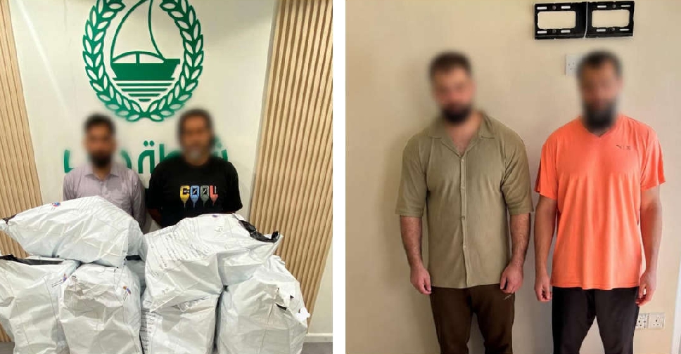 Dubai authorities bust drug smuggling network, seize 200kg of pills
 UAE President restructures International Humanitarian and Philanthropic Council
 Dubai approves AED18 billion development package, including 15km elevated road
 Sheikh Mansour launches Companies for Good strategy to boost impact economy

